Wizard
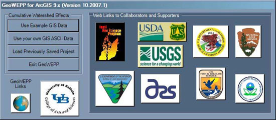
The GeoWEPP for ArcGIS 9.x Wizard provides a launching point for all the GeoWEPP for ArcGIS 9.x tasks like starting a new project, loading an existing project, running an example step, or accessing any one of out supporters websites.
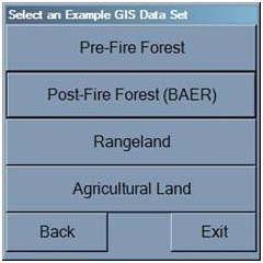
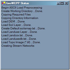
GeoWEPP for ArcGIS 9.x provides four example sets; selecting one will automatically load the required files for you. If you are using your own data,GeoWEPP for ArcGIS 9.x will guide you through a step-by-step loading process to insure all your data has been loaded; if you are missing some important files, like landusedb.txt or soilsmap.txt, GeoWEPP for ArcGIS 9.x will create default files to prevent any simulations errors during your project.
 Toolbar
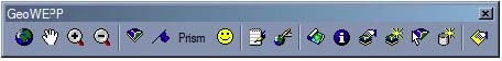
All the functions you need for GeoWEPP is stored on a single tools bar. Placing your mouse over any of the tools will open a tools-tip to help you remember which tool is which; a short description also appears in the lower left window. All the tools are grouped and listed in the order you will most likely use them.
Toolbar
All the functions you need for GeoWEPP is stored on a single tools bar. Placing your mouse over any of the tools will open a tools-tip to help you remember which tool is which; a short description also appears in the lower left window. All the tools are grouped and listed in the order you will most likely use them.
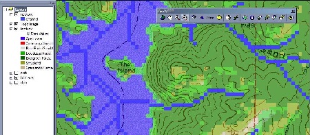
 Window
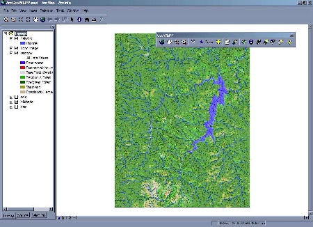
Unlike the earlier ArcView version, this version does not contain large windows that block your view or prevent you from using the functions within ArcGIS. This new approach allows you to perform various tasks within ArcGIS like manipulating other
non-GeoWEPP layers like photos, topo images, or shapefiles without effecting
GeoWEPP.
Window
Unlike the earlier ArcView version, this version does not contain large windows that block your view or prevent you from using the functions within ArcGIS. This new approach allows you to perform various tasks within ArcGIS like manipulating other
non-GeoWEPP layers like photos, topo images, or shapefiles without effecting
GeoWEPP.
 Channel
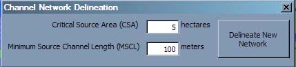
Some of the issues that could not be resolved in the ArcVIew version have been corrected in GeoWEPP for ArcGIS 9.x. For example, there is no need to click the network button three times. Now, one click of the tool will open a Channel Network Delineation window; all you need to do is enter the csa and mscl and click a button letting GeoWEPP handle the rest.
Channel
Some of the issues that could not be resolved in the ArcVIew version have been corrected in GeoWEPP for ArcGIS 9.x. For example, there is no need to click the network button three times. Now, one click of the tool will open a Channel Network Delineation window; all you need to do is enter the csa and mscl and click a button letting GeoWEPP handle the rest.
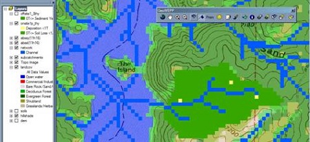
 Legend
All legend information has been incorporated into the Table of Contents within ArcGIS; this includes the resulting T-Value maps.
Legend
All legend information has been incorporated into the Table of Contents within ArcGIS; this includes the resulting T-Value maps.
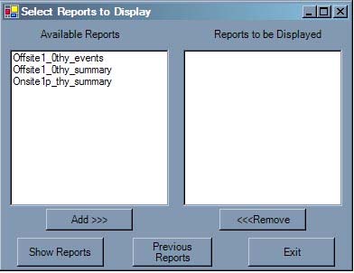
 Reports
You are now able to access the reports created by GeoWEPP without the need to use Windows Explorer to hunt them down. The Reports tool provides an interface that will help you select all the reports you need to view from your current run to any previous run. You can even look at runs from other projects.
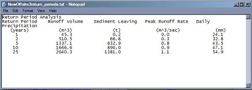
New to this version of GeoWEPP is the Return Periods Analysis Report. This report is the same report generated within WEPP.
Reports
You are now able to access the reports created by GeoWEPP without the need to use Windows Explorer to hunt them down. The Reports tool provides an interface that will help you select all the reports you need to view from your current run to any previous run. You can even look at runs from other projects.
New to this version of GeoWEPP is the Return Periods Analysis Report. This report is the same report generated within WEPP.
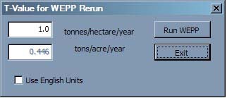
 One-click remap
One click will allow you to remap your results to any new T-Value. Each remapped result is stored in its own raster file and displayed with its own legend. This allows you to turn on and off the layers to make comparisons.
One-click remap
One click will allow you to remap your results to any new T-Value. Each remapped result is stored in its own raster file and displayed with its own legend. This allows you to turn on and off the layers to make comparisons.
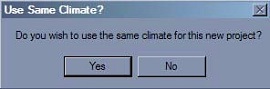
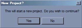
 Multiple Watersheds
This new version allows you to work on one subcathment until completion and then start a new subcatchment using the same soil, landuse, and DEM data without the need to start a new project each time. You are even asked if you wish to use the same climate.
Multiple Watersheds
This new version allows you to work on one subcathment until completion and then start a new subcatchment using the same soil, landuse, and DEM data without the need to start a new project each time. You are even asked if you wish to use the same climate.
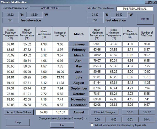
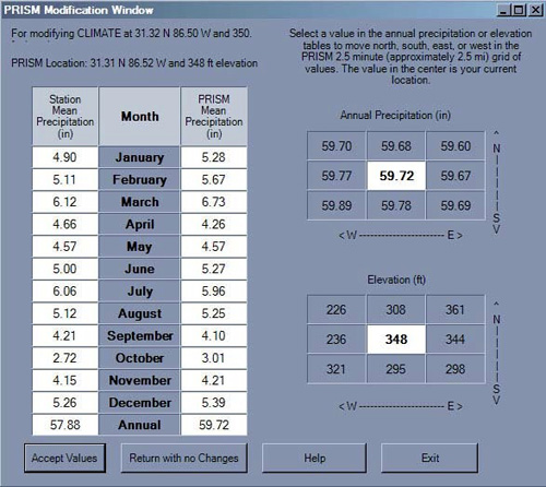
 PRISM
Another addition is the offline version of the the PRISM Climate Generator used in Rock: Clime the US Forest Service WEPP Interface Rocky Mountain Research Station Climate Generator (http://forest.moscowfsl.wsu.edu/cgi-bin/fswepp/rc/rockclim.pl). PRISM allows you to modify any of the WEPP climate station data to match the climate in your study area. This offline version works the same way as the online version (with some slight user interface modifications).
PRISM
Another addition is the offline version of the the PRISM Climate Generator used in Rock: Clime the US Forest Service WEPP Interface Rocky Mountain Research Station Climate Generator (http://forest.moscowfsl.wsu.edu/cgi-bin/fswepp/rc/rockclim.pl). PRISM allows you to modify any of the WEPP climate station data to match the climate in your study area. This offline version works the same way as the online version (with some slight user interface modifications).