|
1
|
- Estimates soil loss from rill and interrill erosion caused by rainfall
and overland flow
|
|
2
|
- Major revision of RUSLE1
- New graphical interface
- Most RUSLE1 relationships revised
|
|
3
|
- Daily calculation of time-varying factors
- (r, k, ls, c, p)
- Developed & tested by experienced and nationally recognized erosion
scientists and conservationists.
|
|
4
|
- Intended to describe main effects
- Intended to be used as a guide for conservation planning
- Intended to represent trends demonstrated in field data
- Not intended to be a precise estimator
- of soil loss or residue cover
|
|
5
|
- 10,000 plot-years of data from natural runoff plots
- 2000 plot-years of rainfall simulator data
- Proven by more than 4 decades of worldwide use by its predecessors, USLE
and RUSLE1
|
|
6
|
- Conservation Planning
- Inventories
- Estimating Sediment Production
|
|
7
|
- Cropland Grazing Land
- Disturbed forestland Construction
- Mined land Reclaimed land
- Landfills Military land
- Other areas where surface overland flow occurs because rainfall exceeds
infiltration
|
|
8
|
- Most powerful and easy-to-use
- erosion prediction tool available
- for use in conservation planning
- at the field office level
|
|
9
|
- In 1998, NRCS made decision to have new erosion prediction technology in
place in time for 2002 Farm Bill
|
|
10
|
- National Instruction for implementation released in OCT 2002
- Application of RUSLE2 for USDA Farm Programs similar to RUSLE1
|
|
11
|
- Full implementation means –
- Program loaded on field office computers
- Databases loaded
- Trained field office staff
- Using for conservation planning
|
|
12
|
- 1998-1999: Develop Technology
for testing
- 2000: Testing by NRCS
- 2001: Develop supporting
Databases
- Train State erosion
specialists
- 2002-2003: Implementation in all
field offices where erosion
is concern
|
|
13
|
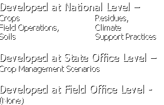
- Developed at National Level –
- Crops Residues,
- Field Operations, Climate
- Soils Support Practices
- Developed at State Office Level –
- Crop Management Scenarios
- Developed at Field Office Level -
- (None)
|
|
14
|
- Selects –
- Location (climate)
- Soil map unit component
- Slope length and steepness
- Crop Management (Use Rotation Builder to develop rotation)
- Supporting Practices
|
|
15
|
- Tools Available -
- Tutorial
- PowerPoint Presentations
- User’s Guides
- Hands-On Training Time
- One (1) day
|
|
16
|
|

 Notes
Notes